Lorry Sat Nav Low Bridge Route Checks UK
Short answer: A lorry sat nav is useful for low-bridge route checks when three things line up: the vehicle profile is entered correctly, the map and software terms fit your journeys, and the driver still checks UK height plates, width limits, weight limits, diversions and delivery-site instructions before committing to the road.
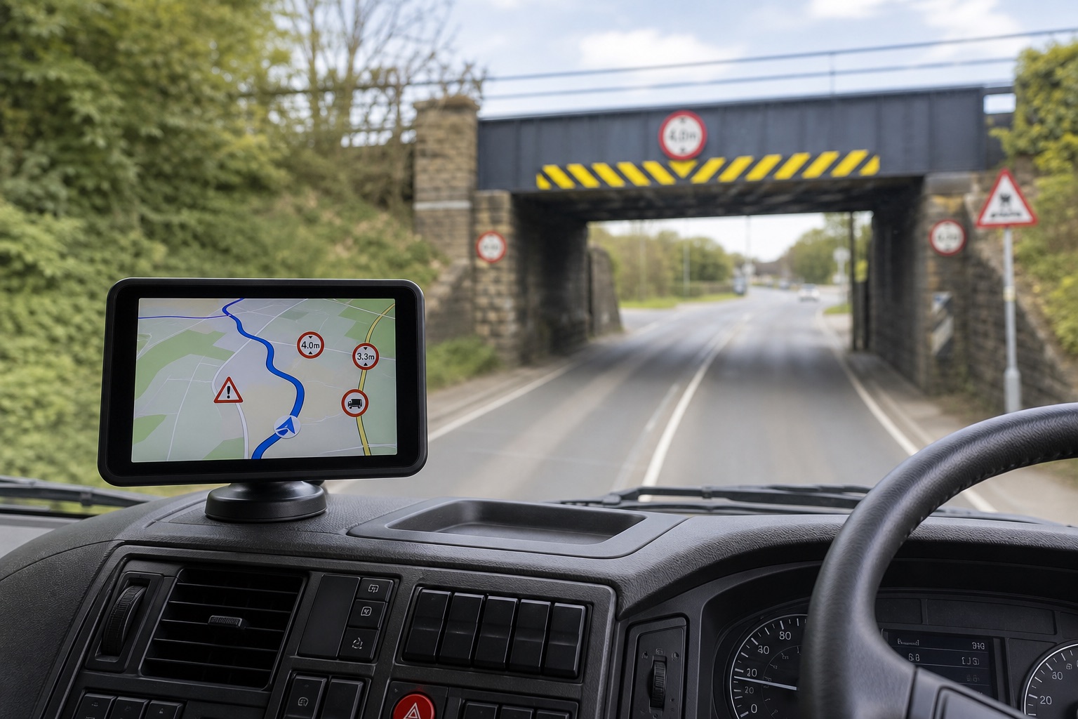
What this guide covers
- How to make a quick low-bridge route check before a lorry journey.
- Which parts of the job a sat nav can support, and which checks still sit with the driver or operator.
- What to confirm before buying if low-bridge routing is critical for your work.
The aim is practical: avoid treating any device as a magic low-bridge filter, while still using the right navigation screen, route preview and vehicle-profile settings to reduce avoidable mistakes.
A direct answer for this route
A lorry sat nav can help by letting you plan with a vehicle profile, preview a route and notice possible restrictions before the vehicle is moving. It cannot prove that every bridge, weak bridge, width restriction, weight limit or temporary diversion has been avoided. UK bridge-strike guidance puts the responsibility on operators and drivers to manage road-safety risk; the sat nav should support that process, not replace it.
The 5-minute low-bridge check before departure
- Confirm the running height. Check the actual vehicle and load height for this journey, including roof equipment, raised bodywork and anything that changes after loading.
- Display the height in the cab. If the vehicle uses a height notice or driver card, make sure it matches the current loaded vehicle, not an old trailer or previous job.
- Enter the full profile. Use the sat nav fields for height, width, length and operating weight where available. If the software does not accept one of those values, treat that as a gap to manage outside the device.
- Preview the route before moving. Look for low bridges, arched bridges, weak bridges, width limits, weight limits, restricted turns, narrow lanes and local access rules.
- Check signs over screen guidance. A red circular height or weight sign is a restriction. Warning signs, low-bridge plates and diversion signs still matter even if the device suggests the road.
- Recheck after any change. If there is a diversion, roadworks, delivery-site instruction or changed load, stop safely and review the route again before continuing.
What the sat nav can help with
| Sat nav can help with | Route preview, vehicle-profile planning, map display, turn prompts and warnings that make the driver check the route earlier. |
|---|---|
| Driver still checks | Actual loaded height, current road signs, temporary works, local restrictions, depot instructions and whether the proposed road is suitable in real conditions. |
| Operator still confirms | Which profile fields the installed software supports, how restriction data is maintained and whether map updates are included or need separate confirmation. |
Where this TruckNav product fits
The current product page describes the hardware and map region, but the hardware specification alone does not prove complete low-bridge or restriction-data coverage:
- Portable 7-inch GPS navigator; 800 × 480 capacitive display; 8 GB storage; Bluetooth; 2.5 mm AV-IN; 3.5 mm earphone connection; European map version.
| Product page | 7-inch GPS Navigator with Bluetooth, AV-IN and European Maps |
|---|---|
| Current detail price | £176.76 when this guide was checked; recheck before ordering |
| Guide focus | Lorry Sat Nav Low Bridge Route Checks UK |
| Map selection | European map version; software version, restriction-data coverage, licence and update entitlement are not stated on the page |
Questions to ask before buying
- Does the vehicle profile accept height, width, length and operating weight for the intended vehicle?
- Does the installed map software include the low-bridge and restriction data needed for your usual UK routes?
- Are the map software version, licence and update terms clear enough for the journeys you plan?
- Is the mount suitable for the cab without blocking the driver's view?
- Are the charger ratings and power connection confirmed before ordering?
- Can every proposed route be checked against road signs, operator instructions and delivery-site access notes?
Routing and suitability boundary
If low-bridge avoidance is mission-critical, confirm the software and update details before ordering. A product name, screen size or map region is not enough evidence by itself; the useful test is whether the device fits your vehicle profile and your route-check process.
Build a small topic path
Continue with the guide that matches the next planning question; each page owns a distinct search need.
Frequently asked questions
Can a lorry sat nav guarantee avoidance of every low bridge?
No. Treat low-bridge and restriction warnings as route-planning guidance, then check the route against current signs, temporary restrictions and the actual vehicle dimensions.
What dimensions should be checked before using a route?
Start with vehicle height, width, length and operating weight, including the load and any equipment that changes the vehicle profile.
Are map updates included with this product?
The current product page does not state the map software version, licence or update entitlement. Ask support before ordering if update terms are essential.
What should a driver do if the device and a road sign disagree?
Follow the road sign, legal restriction, operator instruction or site-specific routing requirement. Do not rely on the device as permission to use a road.