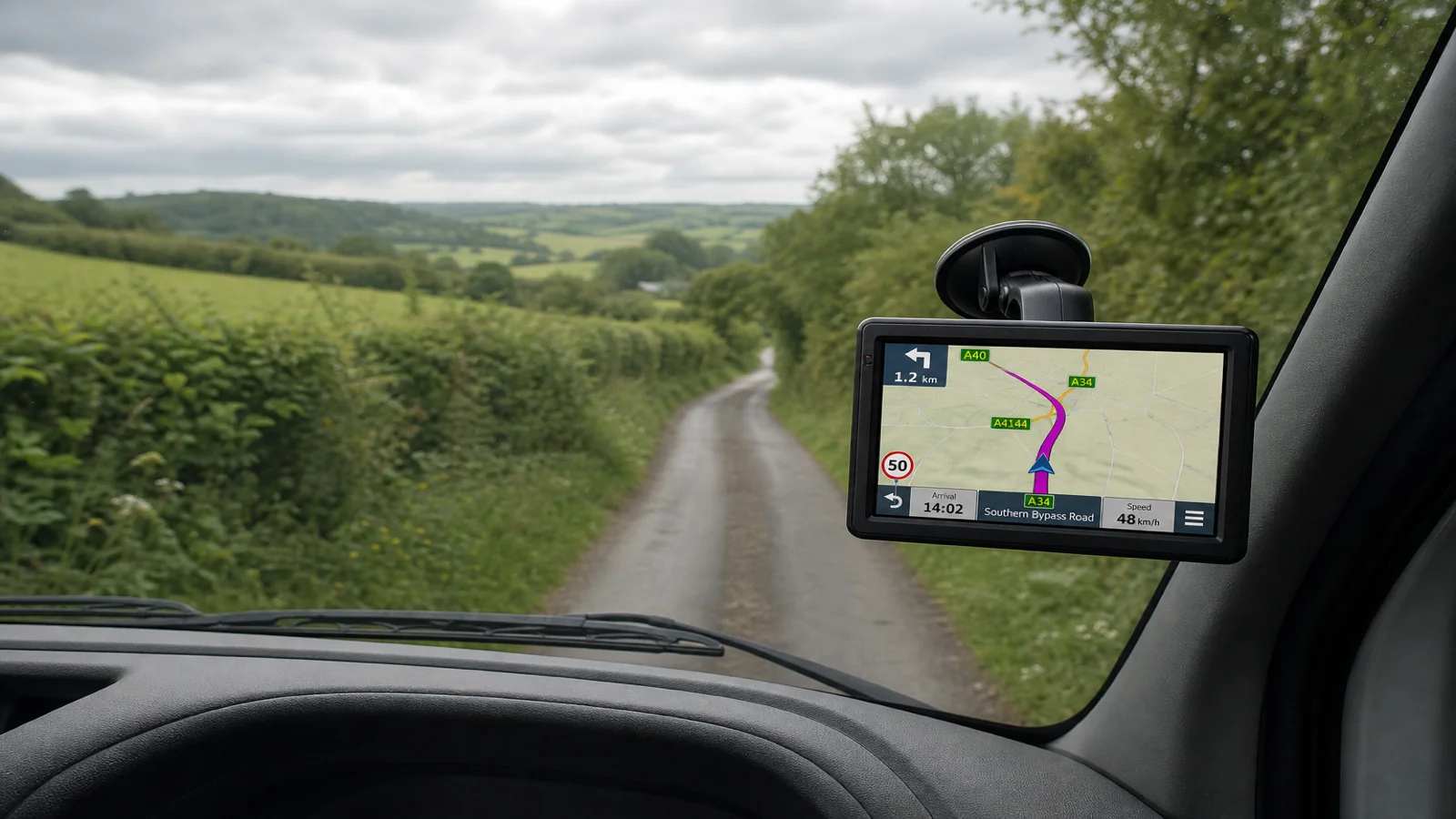
Why Dimension Routing Still Sends You Down Country Lanes (UK)
Dimension routing can avoid many signed height, width and weight restrictions, but it cannot promise that every country lane is wide enough for your vehicle. Mapped limit signs exist in the data; continuous kerb-to-kerb width for every rural road does not. When the sat nav sends you down a narrow lane, treat road signs and what you can see as the final authority — not the blue line on the screen.
What dimension routing can block
When you select an appropriate vehicle mode and enter height, width and weight, a truck-capable sat nav can prefer roads that fit those constraints better than a plain car route. In practice that means it is more likely to steer away from known low bridges, signed width limits and weight-restricted roads that are present in the map data.
That is useful. It is why dedicated profiles exist on units such as the TruckNav 7-inch automotive navigation system, which supports vehicle modes including car, bicycle, ambulance, bus, taxi, truck and walking, plus vehicle profiles using entered height, width and weight. There is no dedicated motorhome profile. Search by postcode, address or POI, then review the route. Lane guidance, voice prompts, 2D/3D views and speed-camera alerts help you follow the plan once you have accepted it.
None of that turns the device into a survey of every hedge-lined lane in Britain.
What it cannot block: continuous road-width reality
A width restriction sign is a discrete fact the map can store. The gradual narrowing of a B-road between banks, parked cars, or overgrown verges is not the same kind of fact. Many country lanes have no permanent “max width” plate even when two vans cannot pass. Dimension routing therefore may still propose a legally unrestricted lane that is physically tight for a wide commercial vehicle or motorhome.
Height works the same way at the margin: known bridge heights and signed limits are the strong cases; unmarked trees, temporary scaffolding and poorly signed works are outside what a static profile can guarantee.
Weight restrictions that are signed and mapped are exactly the sort of rule dimension routing is meant to respect. Unsigned soft verges, weak edges and “unsuitable for HGVs” advisory situations still need driver judgement.
Why the lane still appears on the route
Common reasons a dimension-aware plan still uses a country lane:
- No signed width, height or weight limit exists on that link in the map, so the router treats it as open.
- Your entered figures are missing, outdated, or set under the wrong vehicle mode, so the router underestimates the vehicle.
- The lane is the shortest legal connection between two A-roads after other restricted links were correctly avoided.
- Local conditions — parked cars, roadworks cones, mud — are not continuous live width data on a portable unit.
So the honest expectation is: dimension routing reduces certain classes of mistake; it does not eliminate rural pinch points.
What you should do when the route looks wrong
- Check mode and profile — confirm truck, bus, car or walking as appropriate, and that height, width and weight match today’s combination.
- Scan the upcoming roads — on the 7-inch 800×480 capacitive display, look ahead for narrow links before you commit.
- Prefer signed main roads when unsure — if a short cut looks physically doubtful, choose the longer signed road while you still have space to turn.
- Follow road signs first — temporary closures, access-only plates and bridge signs override the planned line.
- Stop and re-route if needed — do not force a lane because the device insists.
Mount the unit with the suction mount or back clip so glance checks are easy. Keep power on the vehicle charger for longer days. Bluetooth and FM support calls and audio; they do not widen the road. The included 12V rear-view camera on AV-IN 2.5 mm helps when you must reverse out of a mistake; avoiding the mistake still starts with profile honesty and sign reading.
Hardware context without overclaiming
This style of portable navigator — MSTAR2531, Windows CE 6.0, 8 GB plus a 32 GB TF card, 1200 mAh battery, European maps with UK coverage — is built for offline turn-by-turn with vehicle profiles. Maps are IGO or Navitel, with free lifetime updates. There is no live-traffic claim. Use the device as a planning aid inside those limits.
Boundaries in one line
Signed limits in the map: dimension routing can help. Continuous lane width and temporary clutter: your eyes and the signs decide. Always follow road signs, legal restrictions and current conditions.
FAQ
If dimensions are entered correctly, why am I still on a narrow lane?
Because many lanes have no mapped width plate. The router may still use them when they are the remaining legal link.
Does bus mode fix country lanes?
No. Mode and measures improve restriction handling; they do not invent full-width surveys of rural roads.
Should I ignore the sat nav when a lane looks tight?
Yes — slow, assess, and re-route. Road signs and safe physical clearance come before the plotted path.
If you want a portable unit that supports vehicle modes and entered height, width and weight for UK and European mapping — with clear limits on what dimension routing can promise — see the TruckNav 7-inch automotive navigation system.